Embed GPX with elevation
Learnings
- Create a map from a GPX file
- Display an elevation chart for that trace
1. Create a map from a GPX file⚓︎
You simply have to drag&drop a GPX file above the map to automagically create a datalayer with these data.
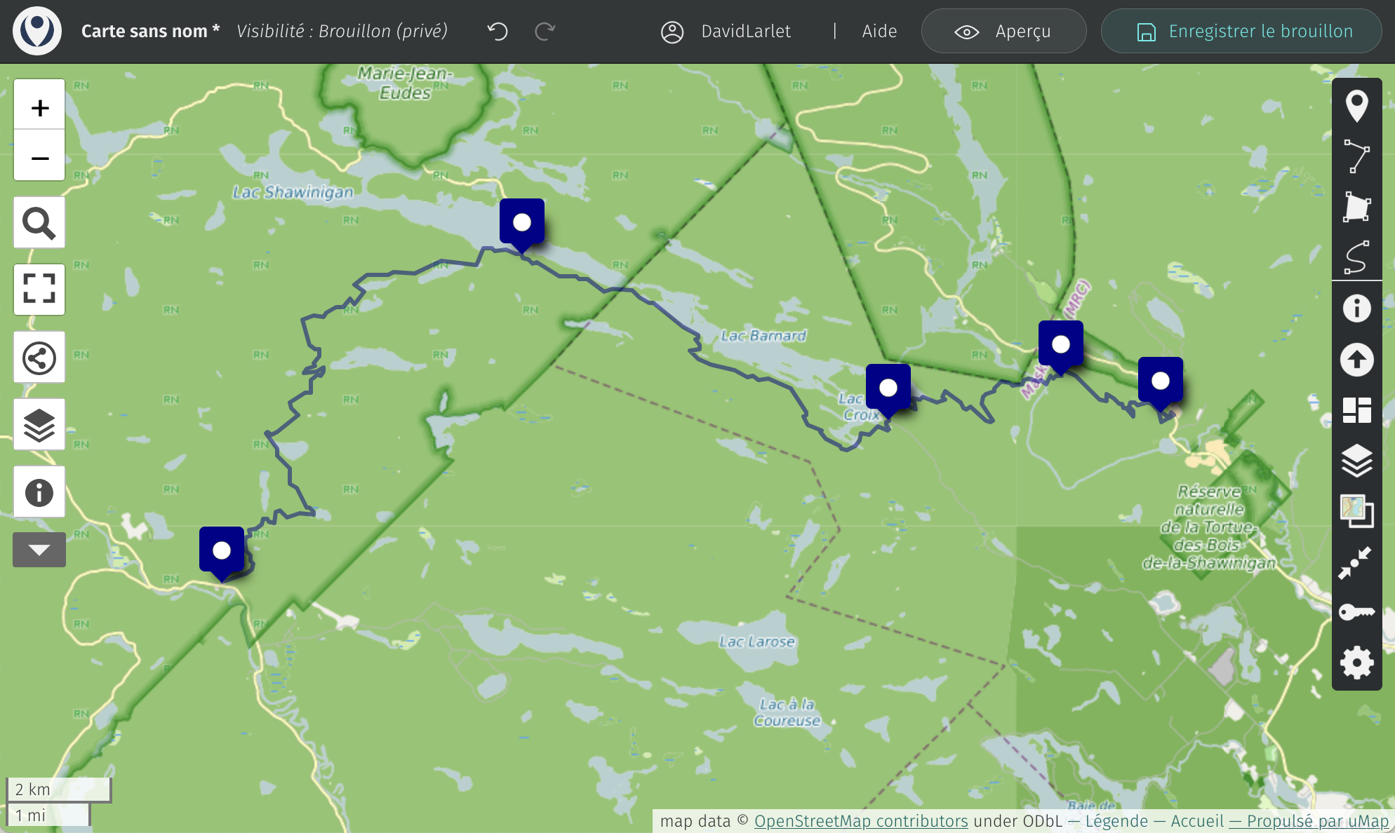
A line should appear on the map with optional pre-defined points according to your source file:
2. Display an elevation chart⚓︎
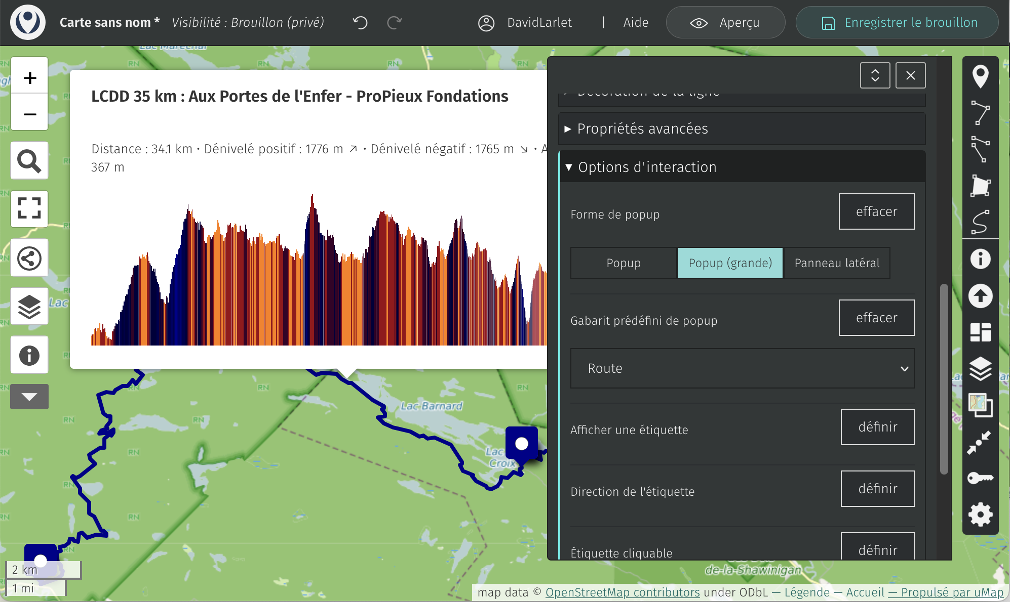
Perform a right-click on the line and choose the editing pencil.
Open Interaction options and switch Popup shape to Popup (large) to give some room to the incoming graph.
Then change the Popup content style from Default to Route.
You should see the popup in the background gaining an elevation graph:
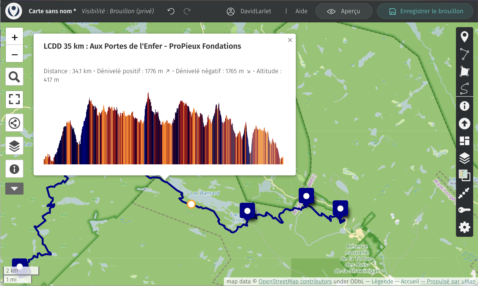
You’ll notice that when hovering the graph, the current position is made visible on the map (orange point on the line) and the elevation is dynamically updated within the popup:
Enjoy your hike!